Spatial Renewable Energy Power Plant Locator
This project focuses on the electricity generation sector. It takes the emissions data from an energy systems model, and identifies optimal locations of renewable energy power plants, specifically, (a) Wind power, (b) Solar power, (c) Biomass, and (d) Geothermal. Several geographical factors play into each of the renewable energy power plants. This project finds locations to meet the energy demand considering the respective factors of each type of power plant. Finally, once the locations are determined, the investment costs for each energy source is determined.
ArcGIS package is used for this project with Arcpy module for Python scripting. Numpy package is used for the mathematical calculations in the model. The output is a customized ArcToolBox tool that will take the input file from the model and generate new power plant locations geographically and write the new power plant investment cost output to a text file.
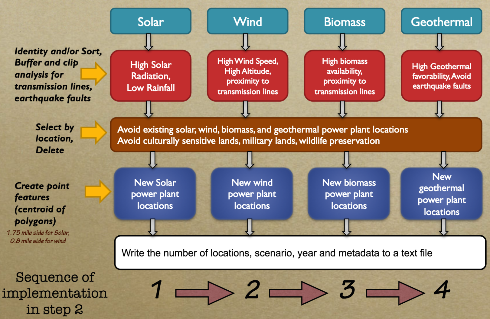
Schematic of the Spatial Power Plant Locator Algorithm
The model is analyzed for the state of California. Two scenarios were analyzed through this tool: (a) business-as-usual scenario and (b) carbon reduction scenario. Under business-as-usual scenario, there are no carbon targets in the state. Under the carbon reduction scenario, the model is trying to meet the state's AB-32 Global Warming policy of 80% reduction of 1990 greenhouse gas emission levels by 2050.
Github Repository Link: https://github.com/kramea/SpatialOptimization